
Your Digital Compass: Navigating Serbia with Ease
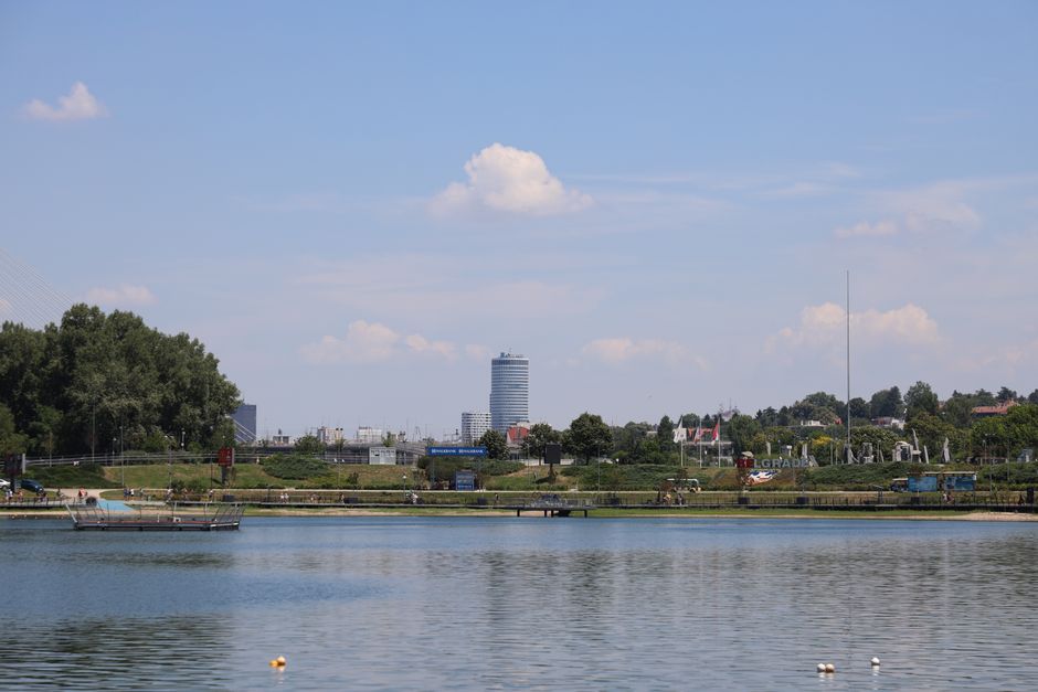
Embarking on your Serbian adventure means having the right tools, and for seamless urban exploration, your smartphone is truly your best friend. Imagine effortlessly gliding through the vibrant streets of BELGRADE, the charming avenues of NOVI SAD, or the historical heart of NIŠ; Google Maps is incredibly reliable here, offering real-time traffic updates and pinpoint public transport routes that will make you feel like a seasoned local.
To keep your digital compass spinning without a hitch, I highly recommend grabbing a local SIM card right after you land, perhaps at Belgrade Nikola Tesla Airport (BEG). Providers like Yettel Srbija or A1 Srbija offer fantastic deals; a 10GB data package, costing around 1000 RSD (approximately 8.5 EUR) and valid for 30 days, is more than enough for extensive map usage and sharing your sizzling Serbian discoveries.
For mastering Belgrade’s public transport, while Google Maps often integrates the data, downloading the ‘BusPlus’ app can give you an extra edge, showing real-time schedules for buses, trams, and trolleybuses. These digital Serbia travel maps are your key to unlocking the cities’ secrets with confidence and convenience, ensuring you never miss a beat or a delicious bite.

Beyond the City Limits: Mastering Offline Maps in Serbia
While city centers boast excellent connectivity, the true magic of Serbia often lies in its breathtaking rural landscapes, where mobile data can sometimes play hide-and-seek. This is where mastering offline Serbia travel maps becomes an absolute game-changer for your journey.
Before you venture out to explore the stunning national parks, ancient monasteries nestled in the mountains, or charming remote villages, make it a golden rule to download offline maps for Serbia on either Google Maps or Here WeGo. Here WeGo, formerly HERE Maps, truly shines in rural areas and smaller towns, offering exceptional offline capabilities that are crucial when 4G coverage decides to take a break.
Trust me, having your routes pre-loaded will save you from any navigation woes and keep your adventure flowing smoothly, allowing you to focus on the incredible scenery rather than signal bars. While the Republic Geodetic Authority (RGZ) provides highly detailed cadastral maps, these are primarily for professional use, so stick to your trusty travel apps for your personal explorations.

Unfolding Serbia: The Enduring Appeal of Paper Maps
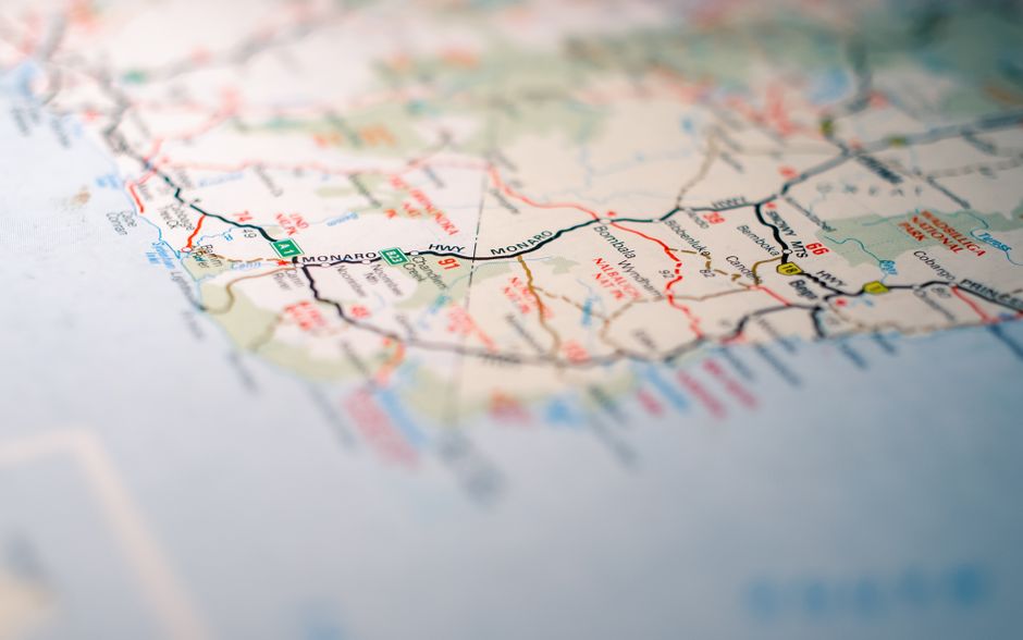
In our increasingly digital world, there’s an undeniable charm and practical advantage to unfolding a physical map, especially when exploring a country as rich in hidden gems as Serbia. Imagine spreading out a vibrant paper map, tracing your finger along ancient routes, and feeling a tangible connection to your journey.
For those who love the tactile experience, physical road maps from reputable publishers like ‘Geokarta’ or ‘Intersistem Kartografija’ are readily available at larger bookstores and gas stations across the country, typically costing around 800-1200 RSD (7-10 EUR). These traditional Serbia travel maps offer a fantastic overview, perfect for planning longer road trips and understanding the broader geography.
You’ll find that the main E-roads, like the vital E75 connecting Subotica, Belgrade, Niš, and Preševo, are impeccably mapped and clearly signposted in both Latin and Cyrillic scripts. However, a pro tip for navigating those charming smaller local roads and villages: many names are primarily in Cyrillic, so familiarizing yourself with a few basic Cyrillic letters for place names will truly empower your exploration and add a fun, local touch to your adventure.
Hitting the Serbian Roads & Rails Like a Local
Getting around Serbia is an adventure in itself, whether you’re cruising on the open road or hopping on public transport, and with the right approach, you’ll be navigating like a true local in no time. If you’re planning to drive, you’ll be pleased to know that the major arteries, such as the E75 highway that seamlessly links Subotica, Belgrade, Niš, and Preševo, are not only well-maintained but also clearly signposted in both Latin and Cyrillic scripts, making your journey straightforward.
However, as you peel off into the more intimate corners of Serbia, be prepared for smaller local roads and village names to primarily feature Cyrillic script. A little homework on basic Cyrillic letters for common place names will go a long way in boosting your confidence and ensuring you never miss a turn to a hidden monastery or a picturesque viewpoint.
For urban explorers, especially in Belgrade, combining your digital Serbia travel maps with local apps is key. While Google Maps provides excellent integration for public transport, downloading the ‘BusPlus’ app can give you real-time updates on buses, trams, and trolleybuses, ensuring you’re always on schedule to catch that aromatic coffee or a vibrant cultural event.