
Offline Adventures: How to Navigate Italy Without Data
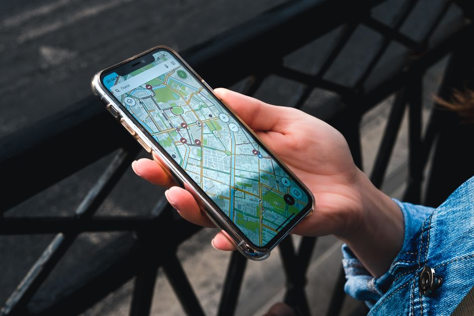
Imagine strolling through a sun-drenched piazza in Florence or a charming alley in Rome, completely confident in your direction, even if your data signal decides to take a siesta! Mastering Italy travel maps and navigation starts with smart preparation, and the ultimate secret weapon is offline maps. Before you even touch down, make sure to download robust offline map segments for all your major Italian cities and regions via Google Maps.
This brilliant feature allows you to save up to 500MB per large city, like the sprawling beauty of Rome or the artistic heart of Florence, ensuring you’re never lost, even in the most ancient, signal-resistant nooks. It’s a true data-saver and a lifesaver in historic centers with their famously narrow, winding streets where GPS can sometimes be fickle. You’ll thank yourself for this foresight when you’re effortlessly finding that hidden trattoria or iconic landmark.
A crucial insider tip for drivers: always be aware of ‘ZTL’ (Zona a Traffico Limitato) zones in Italian cities. These are restricted driving areas, often found in historic centers, and while Google Maps frequently highlights them, always double-check local signage to avoid hefty fines. Even without data, these downloaded maps provide invaluable context, helping you visualize your route and make informed decisions on the go.

City Explorer: Real-Time Transit Apps for Rome, Milan & Beyond
When you’re ready to dive into the vibrant pulse of Italy’s bustling cities, real-time transit apps become your best friends, transforming your urban exploration into a seamless adventure. For the dynamic hubs of Rome and Milan, Citymapper is an absolute game-changer, providing incredibly accurate real-time public transport information. You’ll get precise details for metros, buses, and trams, with estimated journey times accurate to within two minutes, so you can spend less time waiting and more time savoring.
While Google Maps is fantastic for general navigation and public transport planning across the country, Citymapper offers that extra layer of granular detail for its covered cities. To truly unlock the power of these real-time tools and keep your exploration fluid, consider snagging a local SIM card. A 30-day prepaid SIM from providers like TIM or Vodafone, offering around 50GB of data for approximately 20-25 EUR, is more than enough for extensive online map usage and all your other internet needs, making your Italy travel maps and navigation strategy truly robust.
For public transport in smaller towns, where dedicated apps might be less common, keep an eye out for QR codes at bus stops. These often link directly to local transport authority websites or specific apps, like ‘ATAC Mobile’ for Rome’s extensive network, giving you real-time schedules and updates right at your fingertips. Staying connected means staying ahead, letting you effortlessly hop between breathtaking sights and delicious culinary stops.

Riding the Rails & Beyond: Mastering Italy’s Journeys
Italy’s train network is a marvel, whisking you from ancient ruins to sun-drenched coastlines with speed and style, and mastering it is key to unlocking the country’s diverse beauty. Your essential companion for rail travel is the official ‘Trenitalia’ app, readily available on both iOS and Android. This powerhouse provides real-time train tracking, crucial platform numbers, and all the schedule information you need, making your Italy travel maps and navigation seamless across the country.
Beyond the rails, Italy beckons with incredible outdoor adventures, from the dramatic peaks of the Dolomites to the rolling hills of Tuscany. If you’re planning to lace up your hiking boots and hit the trails, the ‘Maps 3D PRO’ app is an absolute must-have. For a one-time purchase of approximately 5.99 EUR, you gain access to incredibly detailed topographic maps of the Italian Alps and Dolomites, complete with essential trail overlays.
This app transforms your phone into a powerful GPS device for the wilderness, ensuring you can confidently explore breathtaking landscapes, whether you’re tackling a challenging ascent or enjoying a leisurely stroll through a mountain village. It’s an investment in safety and exploration, giving you the confidence to venture off the beaten path and discover Italy’s natural wonders.

Venice’s Labyrinth: Mastering Canals and Water Buses
Navigating Venice is an enchanting challenge, a delightful labyrinth of canals, bridges, and hidden calli that conventional maps sometimes struggle to capture. When you’re using maps for walking directions in this unique city, be prepared for frequent, charming detours due to the countless waterways and pedestrian-only bridges. Embrace the unexpected turns; they often lead to delightful discoveries!
For mastering Venice’s iconic Vaporetto (water bus) system, the ‘CheBateo!’ app is absolutely essential. This brilliant tool provides real-time routes, schedules, and estimated arrival times for all the water buses, ensuring you can efficiently glide across the lagoon to your next destination. It takes the guesswork out of island hopping and makes exploring the different sestieri (districts) a breeze.
While Google Maps and Apple Maps are helpful for general orientation, ‘CheBateo!’ offers that specialized, local insight into Venice’s unique public transport. With this app in hand, you’ll feel like a true Venetian, confidently hopping on and off water buses, soaking in the city’s unparalleled charm without missing a beat.